Project “Environmental Protection Using Radar Interferometry” Realized


The University of Sarajevo – Faculty of Civil Engineering has successfully realized the scientific research project “Environmental Protection Using Radar Interferometry,” the first of its kind in Bosnia and Herzegovina, within which the possibilities of applying radar interferometry in environmental protection and soil stability monitoring were explored.
The project was realized based on a Public Call by the Ministry for Support of Scientific Research and Research-Development Projects with Practical Application in the Economy of the Federation of Bosnia and Herzegovina, in cooperation with the United Nations Development Programme (UNDP), through the projects “Better Governance for Faster Economic Growth” (EGG2) and “Translating the Framework for Implementation of the Sustainable Development Goals in BiH into Sustainable and Inclusive Growth” (SDG2BiH), within the R&D grant scheme for 2024.
The project holder was the University of Sarajevo – Faculty of Civil Engineering, and the project team was led by Prof. Dr. Admir Mulahusić, a prominent scientist in the field of remote sensing.
All planned project activities were successfully realized during 2025, in close and exceptionally fruitful cooperation between the research team of the Faculty of Civil Engineering and a partner from the economy – the reputable company BN Pro d.o.o. Sarajevo.
The result of the project is the development of an advanced procedure for monitoring soil subsidence and displacement using radar interferometry (InSAR). The InSAR technique involves interferometric phase comparison of SAR images collected in different time periods and with different baselines, and enables obtaining reliable data on terrain deformations. The obtained results represent a significant input basis for predicting soil displacement, as well as for the development and calibration of numerical models used for simulating terrain subsidence or uplift. It has been demonstrated that the InSAR method can precisely monitor soil subsidence or uplift, which is of exceptional importance for early recognition of landslide risks and other geological instabilities.
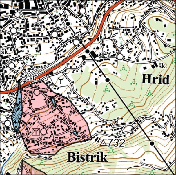
Independent verifications carried out within the project confirmed the relevance and reliability of this methodology for monitoring soil displacement. Based on this, a geospatial database of potentially unstable locations in the Sarajevo city area was created, which served as the test area for the research. Information on the boundaries of critical and endangered areas can be made available to all interested parties through appropriate cartographic displays. An example of such a cartographic document can be viewed here: https://www.bnpro.ba/wp-content/uploads/2025/12/TK25_Sarajevo.pdf
In this way, it is possible to ensure reliable information on soil stability planned for the construction of infrastructure and other facilities, improve the quality of life of the population, contribute to the protection of plant and animal life as well as natural and economic resources, and enable continuous monitoring of areas where landslides may threaten human lives and key infrastructure facilities.
It is important to emphasize that the developed methodology does not apply only to Sarajevo – it can also be applied to other areas of Bosnia and Herzegovina where there is suspicion of soil displacement or an increased risk of landslides.
The University of Sarajevo – Faculty of Civil Engineering and the company BN Pro d.o.o. Sarajevo express their sincere gratitude to the Federal Ministry of Education and Science and UNDP for their continuous and invaluable support. Through projects such as this, efforts are made to contribute significantly to safety, sustainable development, and the well-being of society as a whole.